Mapping Chopwell Wood
We had heard from numerous locals that finding a map of Chopwell Wood is difficult and that directional signage in the woods is sparse. There are official maps of the woods. Friends of Chopwell Wood have published a good pedestrian map and there are beautifully illustrated maps from late 19 century to mid-20th century that we look at a lot.

1899 - Chopwell Plantation (from Forestry Commission)

1919 - Chopwell Plantation (from Forestry Commission)
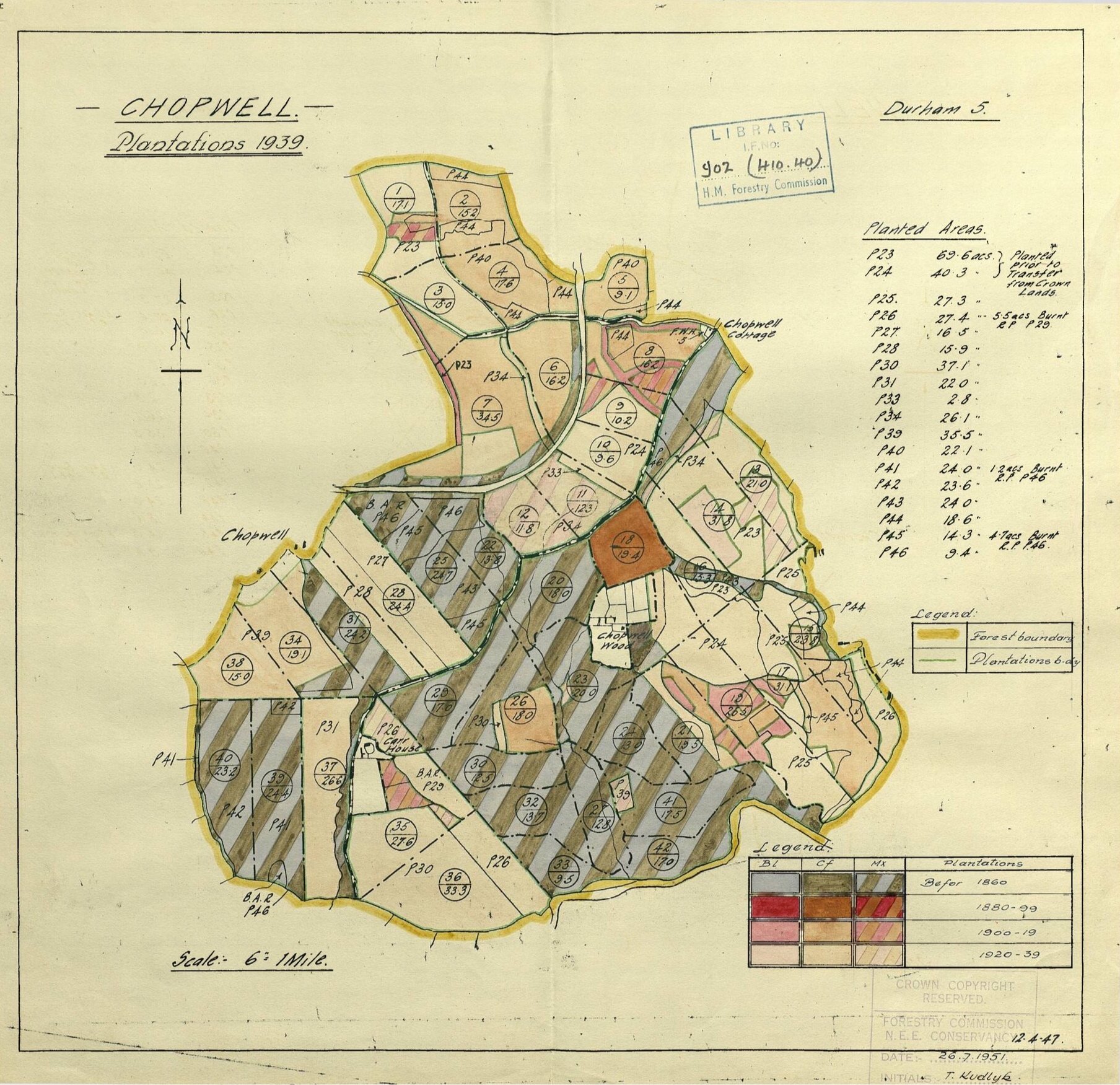
1939 - Chopwell Plantation (from Forestry Commission)

1951 - Chopwell Plantation (from Forestry Commission)
In April, our artist friends Jane Gower and Tony Scandrett took us for a couple of video walks through the woods. Inspired by an annotated map that Jane and Tony made, Mia drew our walks live, mapping the route as best she could without being on the ground. A strange type of cartography emerged that is part location-based and part speculative error.

April 7 - A walk in Chopwell Wood with Kate, Jane, and Tony

April 15 - Chopwell walk with Jane & Tony
Update: we recently did a talk with Jane and Tony as part of GIFT Exchange and discussed the lack of maps for Chopwell Wood. Debbie who was in the audience asked if could email her a link to a map only to changer her mind. She says: “thanks for the offer of maps - I would like to see them but after the discussion today, I might forget them afterwards. I realise that I associate the woods with not having to hurry in case I get lost - so I will walk home from school with the kids through the woods but I don't walk through the woods to pick them up in case I'm late. I think I would like to keep the association with having time to get lost.”